Facilitating Joint Spatial Planning for Imperiled Species and Coastal Resiliency with Habitat Models and Social Data
Michael Allen, Postdoctoral Research Associate
Rutgers University
Abstract
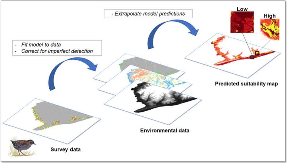
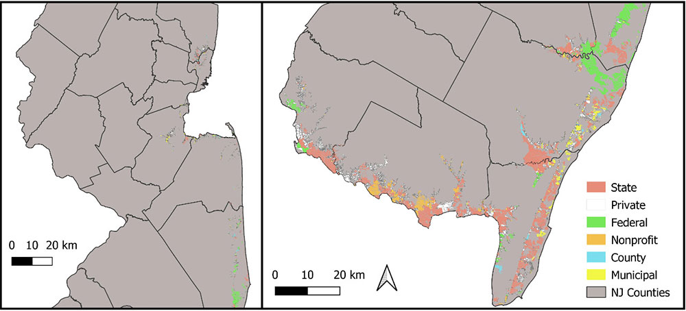
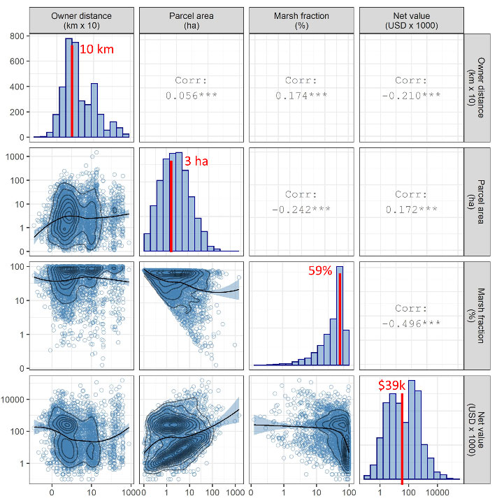
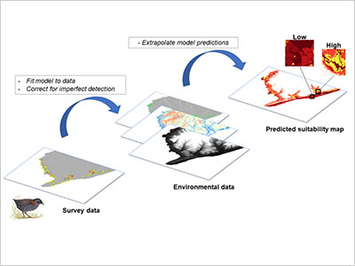
Sea level rise compounds extinction risk for coastal species while posing an existential threat to expanding coastal human communities. Resiliency actions to protect human life and property can further exacerbate threats to biodiversity. Joint spatial planning is needed to reconcile resiliency and conservation efforts but this requires integration of spatially-explicit data from disparate domains, namely: species biology and occurrence; the geography of physical threats; and the social landscape in which management and restoration decisions will occur. We present a case study of integrating species distribution maps for the eastern black rail (Laterallus jamaicensis jamaicensis), a salt marsh-dependent bird threatened by sea level rise, with social information in urban coastal New Jersey, USA. We illustrate how Bayesian occupancy models for this species can be integrated with tax parcel information to inform potential hurdles and synergies between conservation and resiliency actions in a way that makes the information both available and useful to coastal planners.