Design Research: A Landscape Approach To Carbon Sequestration
Lela Robinson, Mapping Consultant
Cornell University Cooperative Extension
Abstract
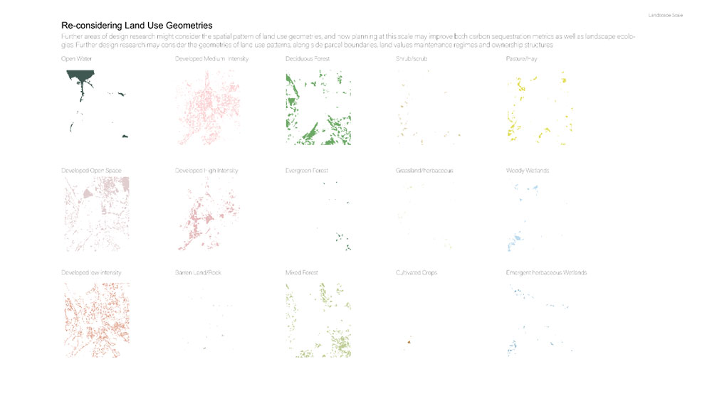
The poster visualizes a landscape scale inventory of carbon sequestration, as an initial step in the design research process. Ongoing work in design research makes a case for the value of and need for design research, and compares design research to conventional research models (Vanucchi). Highlighted in this work are approaches to climate change-based risk to demonstrate the value of exploratory research that makes uncertainty central to the research design (Vanucchi). The map utilizes a land use inventory method for carbon measurement, taken as a means to consider and achieve local carbon neutrality. The methodology follows The Philipstown Inventory 2020. The report is one of the first in New York State to use real local data to measure the full life-cycle carbon emission impacts of the goods and services and to estimate the work of natural resources to remove and store carbon from the atmosphere (Angell, 13). The maps, in their initial stages, are intended as a tool for community leaders, the public, and academics to come together and engage in topics focused around carbon sequestration and climate change.